
Chapter 4
Third-party layers
In addition to the catalog’s own layers, the viewer can display layers from other institutions that publish their maps as web services. They are called “Third-party layers”. They provide context for a finding (relief, boundaries, protected areas, land cover) without loading that data into Tesela. This chapter explains how they look, where they come from and why some appear only when you are signed in.
Own layers and third-party layers
The institution’s own layers (for example municipalities or protected areas) live in the catalog, are organized into thematic groups such as “Territorial reference”, and can be queried, downloaded and cross-referenced with the analyses.
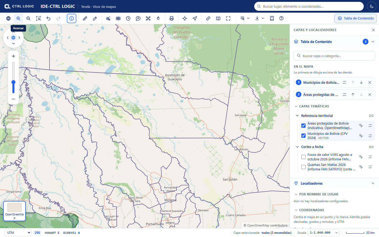
Third-party layers are different: they are not in the Tesela database. Another institution publishes them and Tesela only displays them.
How they work
- They are external, read-only WMS services. An administrator registers them under “Settings → External services” and chooses which of their layers are offered in the viewer.
- The browser never connects to the external service. The map images are requested from the Tesela API, which queries the service from the server and forwards only images. For this reason the services’ addresses and credentials are not exposed.
- Tesela does not validate this data and is not responsible for how current it is. It depends on the source service being available.
How they appear in the viewer
The Table of Contents shows the “Third-party layers” group, with a counter of layers that are switched on. Inside the group:
- A notice reminds you that the data belongs to other institutions, that Tesela only displays it, that it does not validate it or answer for how current it is, and that it depends on the source service.
- Each service is shown with its name, its type (for example WMS) and the line “Source: …” naming the owning institution. If the service has a usage warning, it is shown below.
- Each layer carries the “Third party” label. If it is visible only to signed-in users, it also carries the “Internal” label.
- When you switch a layer on, an “Opacity” control appears and, if the provider published one, a link to the “Provider record”.
- At the foot of the group, the sources of the layers that are switched on are cited (“Data from: …”). Cite them if you reuse the data.
Which services exist and why some are internal
Each service is either public (visible without signing in) or internal (only when signed in). A service is always created as internal, and an administrator makes it public only when sure that its license allows it. A service with a credential can never be public.
The services already registered in this installation are:
| Visibility | Service | What it offers |
|---|---|---|
| Public | NASA GIBS | Relief and bathymetry |
| Public | IGN Argentina | Provinces, departments and protected areas |
| Public | INPE Brazil (PRODES) | Amazon biome and accumulated deforestation |
| Internal | terrestris | Topographic map based on OpenStreetMap |
| Internal | SERNANP Peru | Layers published by Peru’s protected natural areas service |
| Internal | IGM Ecuador | Layers published by Ecuador’s Military Geographic Institute |
| Internal | EOX Sentinel-2 | Sentinel-2 mosaic |
| Internal | GEBCO | Global bathymetry |
A service remains internal when its license has not yet been verified, when its use is non-commercial only or when it does not expressly authorize public browsing. In the meantime, only signed-in people can see it. This protects the institution from reusing data outside its owner’s conditions.
Bolivian data from the INE and GeoBolivia is still pending an agreement and is not available in the viewer.
How an administrator registers a service
This step belongs to administration (chapter 15) and requires a specific permission. It is summarized here so that you know where the layers come from.
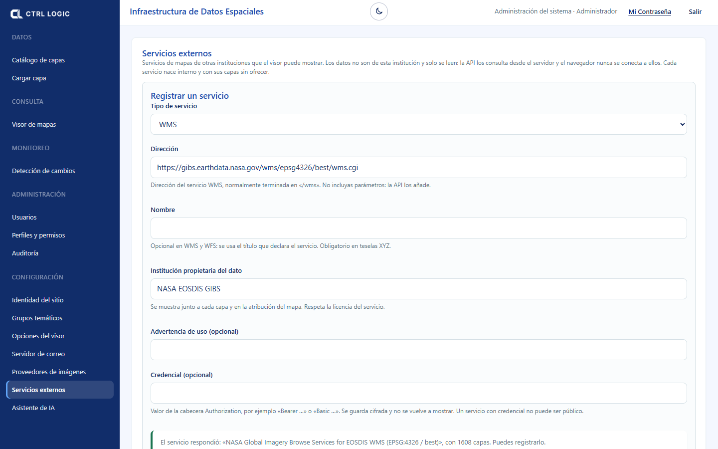
- Go to “Settings → External services”.
- Choose the service type, enter the address (without parameters: the API adds them) and the “Institution that owns the data”.
- Click “Test connection” to see the layers it publishes and then “Register service”.
- Choose which of its layers are offered in the viewer.
- Decide whether the service is public or internal (“Make public” asks for confirmation).
Limits
- Third-party layers have no “Identify” (their attributes are not queried when you click) and no legend inside the viewer. To understand their colors, consult the provider record.
- They are context imagery: they are not part of the cross-references in Tesela’s analyses, which use the catalog’s reference layers.
- If the source service does not respond, the layer is not drawn.
A third-party layer is a visual reference, not a Tesela result. Any coincidence with a finding requires verification with the institution that publishes the data.
Summary
- “Third-party layers” are read-only WMS services from other institutions.
- The browser never calls the external service: everything goes through the Tesela API.
- Each layer shows its source and the notice that the data does not belong to the institution.
- Internal services are visible only when signed in, because the license is unverified, the use is non-commercial or public browsing is not authorized.
- There is no attribute identification or legend in the viewer.